
 GPS Geotag Photos & Camera Map
"Is GPS Geotag Photos & Camera Map working?"
GPS Geotag Photos & Camera Map is working normally
All systems are operational. GPS Geotag Photos & Camera Map is accessible and functioning properly.
Status Chart
This chart displays the hourly status data for over a 24-hour periodTimeline
A chronological log of system events, performance fluctuations, and user reports. Each entry is tagged with time, status, affected regions, and resolution details for comprehensive tracking and analysis.
Service Status: All systems operational and responding normally
Performance Trend (24h): Service stability is degrading
Community Reports: No issues reported by users in the last 24 hours
Global Availability: Working normally worldwide
What issues are you experiencing?
Please choose the type of issue you're having with the Android app.
Reporting chart
Recent reports
No recent votes yet
GPS Geotag Photos & Camera Map
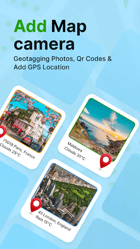
PhotographyAbout this app
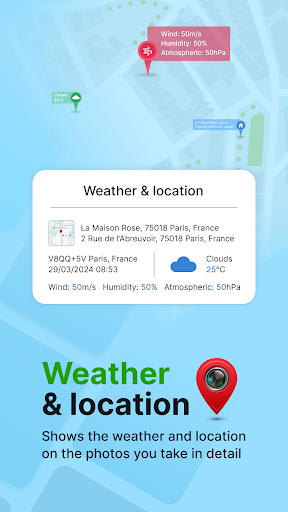
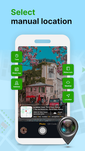
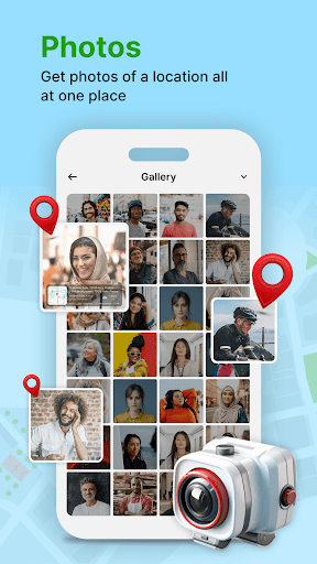
GPS Geotag Photos & Camera Map app helps you add location to your photos so you can keep track of when and where they were taken. You can also add datetime, live map, latitude, longitude, weather to your camera photos.
This GPS Camera app support capture stunning photos while automatically embedding GPS coordinates, altitude, address into the imag...
This GPS Camera app support capture stunning photos while automatically embedding GPS coordinates, altitude, address into the imag...
App Screenshots


User Reviews from Store
Showing 8 of 10 reviews (Page 1 of 2)

Rui Saraiva
Sep 22, 2025
it has so many ads, it makes the app impossible to use

Wilfredo Zapanta
Sep 22, 2025
Great!

Kas pillay
Sep 21, 2025
Yet another hopeless app. It don't need anything related to searching a location or anything remotely close... There's no option. Yet another app dedicated to ads.

Akansh Agarwal
Sep 21, 2025
fake app

Jean Events
Sep 21, 2025
What a load of rubbish 🗑

John Kontarini
Sep 20, 2025
it sos only adds n to intallothraplcation using gools new way of promoting adds. you can not stop the add until it finish showing.

Mnikezeli Mfabana
Sep 20, 2025
This app is helpful

David Xu
Sep 19, 2025
scam
Comments & Discussion
0 Comments
Be the first to comment on GPS Geotag Photos & Camera Map status
Share your experience with the community